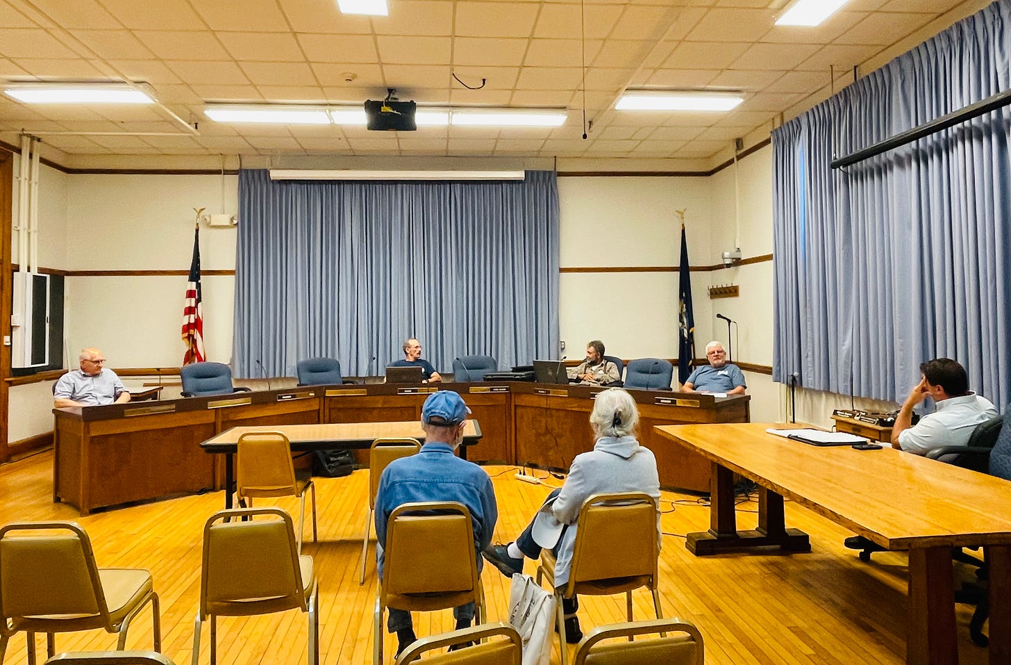
BAR HARBOR—Hurricane Lee isn’t expected to impact Maine until Saturday, but that doesn’t mean it wasn’t a hot topic of conversation at the Harbor Committee meeting Monday night in Council Chambers at the Bar Harbor Municipal Building.
Harbor Committee member Jonathan Carter had words of advice.
“I’m telling young guys, you want to watch it. You want to watch this one,” Carter said.
Usually, he goes to Northeast Harbor with his boat to wait out the hurricanes, but this time he plans to head to Rodney Murphy’s to clean his boat’s bottom.
Member Pancho Cole said, “I’m moving my boat.”
After murmurs of agreement, Carter said, ”There’s another one coming right behind it.”
“That would be a repeat of Hurricane Edna and Hurricane Carol.”
Bar Harbor Police Special Services Lieutenant and Harbormaster Christopher Wharff said all the floats and ramps on the east side of the town’s municipal pier are coming out. The ramps, floats, and police boat is moving to Northeast Harbor for the weekend.
Carter said that though it’s normally an option, for many boaters Northeast Harbor might not work this weekend. “Northeast Harbor is full now, so where do you go?”
Usually, he said, the storms come later in the season when a lot of the recreational boats are gone.
In general, Bar Harbor is considered to be in a moderate risk hurricane zone. Since 1930, there have been 29 recorded hurricanes. The largest, in 1961, was Hurricane Francis with maximum sustained winds of 110 knots. It made landfall in Nova Scotia.
Hurricane Carol hit in 1953 with 140 knot winds and 962 barometric pressure, making landfall east of Saint John. Three people died in Maine. The storm caused $10 million in damage. Then Edna arrived, ten days later. Edna caused $15 million in damage and killed eight. There was flooding. Rail lines and roads were washed away.
Hurricanes Carol and Edna in Maine, 1954, filmed by Earle Fenderson from WGAN-TV (now WGME-TV/Portland) available from Northeast Historic Film illustrates some of the strength of the storm.
Hurricane Arthur hit in 2014 (max 85 knot winds), also making landfall east of Saint John.
Carter wasn’t sure how the newer wire gear used for lobstering was going to stay put during a storm as opposed to the old wooden gear. “They travel and clump up.”
“There are going to be some nice bouquets of buoys,” Wharff said.
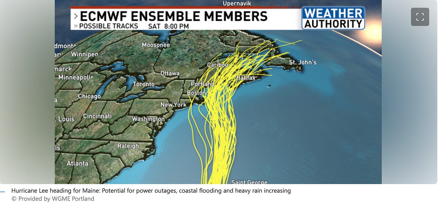
Hurricane Lee is expected to impact the area on Saturday with storm surge and high winds. The hurricane is currently expected to follow the eastern coast of the U.S. and then veer toward Nova Scotia, but some models still have a more westerly turn, which would increase the impact to Mount Desert Island.
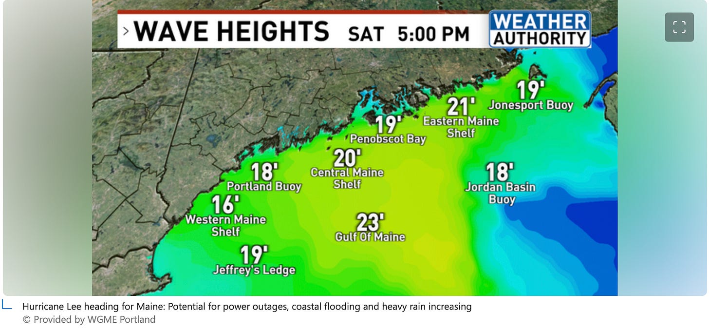
The wave heights for Saturday on the Eastern Maine shelf are predicted at 21 feet according to WGME meteorologist Christian Bridges
Bridges said,
”While exact wind gust levels are still unclear, things are starting to come into focus. Expect a much more definite forecast on winds during the day on Thursday. With the center of Lee likely passing over or near Down East Maine, the Midcoast and Down East regions will likely see the strongest winds, and thus the highest power outage potential.”
Cruise ships scheduled for the weekend and this week have cancelled.

On Wednesday morning, Yahoo News wrote, “There is an increasing risk of wind, coastal flooding, and rain impacts from Lee in portions of New England and Atlantic Canada beginning Friday and continuing through the weekend.”
"Landfall is most likely in Nova Scotia, Canada, this weekend, but any waver in the track caused by non-tropical weather systems such as the high pressure to the east and the approaching jet stream could pull the hurricane westward toward New England or push it farther east toward Newfoundland and Labrador," said AccuWeather meteorologist Bernie Rayno.
At this time, AccuWeather meteorologists expect a high risk to lives and property from damaging winds and flooding on much of Nova Scotia, Down East Maine and southwestern New Brunswick from Saturday to Sunday.
“Could be something; could be nothing,” Carter said at the meeting, which made a murmur of others who added, “Hard telling, hard knowing.”
“I would like to be a weather man, they can be wrong so many times and keep their jobs,” Carter said before he asked Board Chair Jeff Miller what the yacht club was doing in preparation.
Miller said he sent out a notice to members to come get their dinghies because the club will probably do something on Wednesday. They will probably pull the ramps at least, he said.
Carter, “I was young when we got one. I really don’t remember it a lot…. We really haven’t had a major one come. I mean we’ve had some awful scares.”
GEAR LOSS
There were a quick couple of asides about potential fishing gear loss due to private yachts or cruise ships. Wharff confirmed Tuesday that he has not had any fishermen reach out to him yet with issues.

TALKING WHEN NO QUORUM
There were six people in the audience attending. One was Town Council Chair Valerie Peacock, another was her son. Another was a member of the Warrant Committee. There were four board members attending, Carter, Cole, Robert Garland, and Miller.
Cole asked if they could talk about stuff on the agenda if there is no quorum.
Wharff had assumed they could discuss, but that they couldn’t vote. Val Peacock went to check.
FERRY TERMINAL PLAN
The representative from GEI, the firm helping the town figure out its plan for the town’s potential marina at the Bay Ferries/Cat site had health issues and did not make the meeting.
According to Wharff and Miller, the GEI representative will be out for a while, possibly months. The business’ intention is to have some form of representation and an update for the committee’s October meeting, Miller said.
DINGHY FLOATS AND WHERE TO PUT THEM
Dinghy floats at the town’s pier also became a discussion.
Carter said, “We’ve had a lot of yacht traffic this year. Those finger floats can only hold so many.” Right now, they are barely holding on, he said.
Throughout the years, there have been many different ideas of how to expand the system to hold dinghies, he said, but the town has never done anything.
Wharff requested that if anyone had any good feasible ideas to add a dinghy float to let him know. They can’t expand the one they have on one side. The only option would be to put something in between the dinghy floats on the west side. But then if the tide is up, people wouldn’t be able to get to the dinghies.
Wharff said he’d love to hear ideas and he hasn’t come up with a solution. He hopes the ferry terminal will take off some of the pressure.
Miller talked about dinghies that are tied up that are transient as potentially being part of the ferry terminal plan.
Peacock asked about Ocean Properties, a private company close by, being a possibility. Cruise ships tender to the property.
At one point, Wharff said, there was a $5 fee for day boaters, but then there was pushback against it.
Miller said, “There was pushback when we put parking meters in.”
The committee discussed how taking a slip away from the municipal pier, and making a skiff dock would lose a lot of revenue for the town. A skiff permit is $35-45 for the season. It costs
$4 per foot for yachts per night. Yachts also pay utilities if hooked up to water or electrical.
Tuesday, Wharff said, “We have not had any additional demand for dockage, in fact I would say that demand has been less for dockage than last year. I think we have seen a few more small boats anchoring but nothing major.”
GRANT
After the December storm that coincided with a king tide, Wharff said that he started to worry more about the pier and rising coastlines.
He has applied for two different federal grants. One was for an engineering study on the pier and boat ramp—to find what the town has to work with and what the town would want to build up with sea level rise.
The grant request is $200,000 for an engineering study.
“I’ve been down there for 53 years and back in the 70s that was underwater all the time,” Carter said. “If a storm comes on a big tide, that pier is going underwater.”
Those tides are king tides. At one point, Carter said, they had even talked about putting the harbormaster’s office at the end of the pier. That was nixed.
“It’s going to keep washing out,” Carter said.
A 2002 article in the Bangor Daily by Liz Chapman details the discussion the Bar Harbor Town Council had about the pier and sinkholes beneath it.
HOISTS
The new hydraulic hoist is operational and should be far more durable that the electric ones that the town has had before, Wharff said. The final cost hasn’t come in, but he expects it should end up just over $30,000.
HOW TO PREPARE FOR A HURRICANE
When preparing for a hurricane or tropical storm, the CDC suggests
“Making a plan
“Write down emergency phone numbers and keep them on the refrigerator or near every phone in your house. Program them into your cell phone too.
Prepare an emergency supply kit.
Locate the nearest shelter and different routes you can take to get there from your home. If shelter locations in your area have not been identified, learn how to find them in the event of a storm.
Pet owners: Pre-identify shelters, a pet-friendly hotel, or an out-of-town friend or relative where you can take your pets in an evacuation. Local animal shelters may be able to offer advice on what to do with your pets if you are asked to evacuate your home.”
“Gathering emergency supplies
“An emergency food and water supply.
An emergency medicine supply.
Emergency power sources such as flashlights (don’t forget extra batteries).
Important documents, including medical documents, wills, passports, and personal identification.
A fire extinguisher. Make sure your family knows where to find it and how to use it! Read the National Fire Protection Association’s tips for using fire extinguishers.”
“Get your car ready if you have one, if not make a plan with someone who does.
“Fill your car’s gas tank.
Move cars and trucks into your garage or under cover.
Always keep an emergency kit in your car.
Visit Ready.gov for information on how to prepare your car and what to include in your kit.
“Get your family and pets ready.
“Go over your emergency plan with your family.
Keep checking for updates about the storm. Watch TV, listen to the radio, or check online.
Call the hospital, public health department, or the police about special needs. If you or a loved one is older or disabled and won’t be able to leave quickly, get advice on what to do.
Put pets and farm animals in a safe place. Read more about pet safety during an emergency.
“Get your home ready.
“Clear your yard. Make sure there’s nothing that could blow around during the storm and damage your home. Move bikes, lawn furniture, grills, propane tanks, and building material inside or under shelter.
Cover up windows and doors. Use storm shutters or nail pieces of plywood to the outside window frames to protect your windows. This can help keep you safe from pieces of shattered glass.
Be ready to turn off your power. If you see flooding, downed power lines, or you have to leave your home, switch your power off.
Fill clean water containers with drinking water. You’ll want to do this in case you lose your water supply during the storm. You can also fill up your sinks and bathtubs with water for washing.
Check your carbon monoxide (CO) detector’s battery to prevent CO poisoning.”
There is currently one way for vehicles off Mount Desert Island. When emergency evacuations occur, typically both lanes are open for vehicles to leave. Hancock County Emergency Management Agency coordinates county-wide plans for emergencies. Its Facebook page is here.

LEARN MORE ABOUT STORMS THAT HAVE HIT MDI
The Southwest Harbor Public Library on Tuesday, October 3 at 5:30 will host "Wicked Pissah! Storms, Survival and Sea Level Rise."
Maine has a reputation for bad storms, specifically the notorious nor'easters that blow through in the winter. But we also get hurricanes, blizzards, and ice storms that wreak havoc on buildings, roads, ships, and utilities. Death-defying stories of survival are told and retold around hearths and over coffee for generations. Islanders love a good storm, it seems to run in the blood. Bad weather and how we survive it is a link that connects us to our ancestors.
MDI Historical Society Director Raney Bench will tell several tales of storms and survival from our past, starting with the bridge connecting the island to the mainland washing out in 1851, hurricane Edna sinking boats in 1954, Daisy washing over Mount Desert Rock in 1962, and what the December 24, 2022 storm tells us about our future.
LINKS TO LEARN MORE
How to prepare for a hurricane
To register for the Southwest Harbor Library talk, go to https://swhplibrary.libcal.com/event/11105467?hs=a


