More Than 500 Give Their Input About How To Make Bar Harbor's Streets Safer
BAR HARBOR—The people of Mount Desert Island have a lot to say about Bar Harbor’s streets. Those comments come in conversations at the grocery store, text messages, social media posts and comments, select board and council meetings, and now, also, as part of surveys and maps used by the town in the hopes of making the roads safer.
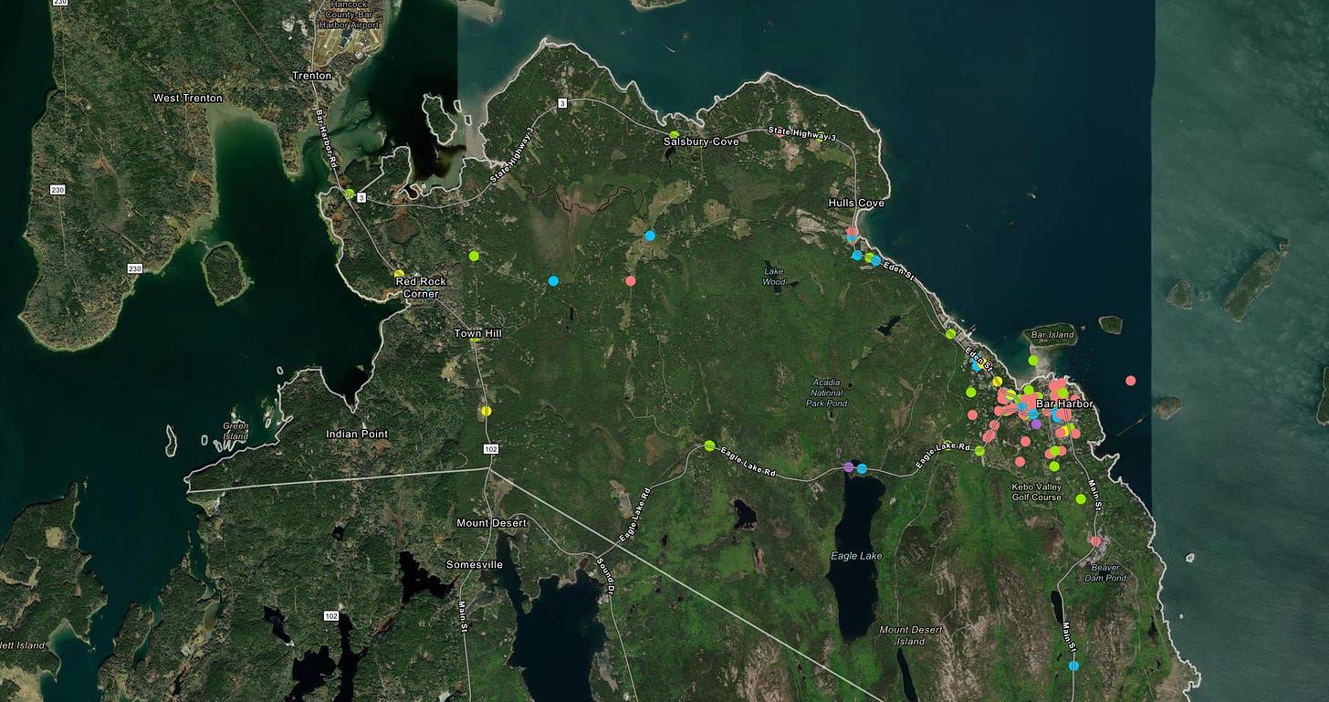
More than 500 people responded to a Bar Harbor safety survey that’s focused on finding out information on making Bar Harbor’s streets safe. An interactive GIS map on the town’s website has had over 700 pins and comments.
People have a lot to say about how to make Bar Harbor’s streets safer to travel.
A bicycle and truck collide on School Street. A pedestrian is hit and killed near the Chart Room and at Jackson Lab. A bicyclist narrowly escapes a collision on the Eagle Lake Road, the Crooked Road, Cromwell Harbor Road. Sight lines are obscured on Ledgelawn, Norway Drive, Atlantic Ave, Hancock Street.
“I want to emphasize how important the project is,” Bar Harbor Staff Planner Hailey Bondy told Bar Harbor Town Councilors on Tuesday night. The project is driven by multiple department heads in the town.
The comments on the GIS maps delve into specifics and generalities.
One wrote, “The storm drains and man hole covers throughout town and most notably on Mt. Desert St. are a hazard for cyclists. Also in general there are people walking everywhere mostly not on the sidewalks on side streets. Then there are e-scooters traveling the wrong way.”
“Almost anywhere in town there are e/scooters traveling at a high rate of speed, often on the wrong side of the road and often going the wrong way on one way streets,” wrote another about a road downtown.
Another mentioned the lack of a shoulder on Route 3 by the Tarn, making it so bicyclists have to go into Route 3’s travel lane at a point where vehicles are travelling at high speed.
At locations, such as the corner of Ledgelawn and Mount Desert, commenters often concur about sight lines and obstructions. This also happens on Route 3 where commenters say there needs to be a safer way for people to cross the street by Pirate’s Cove.
However, the commenters on the GIS map don’t always agree.
“School Street is one-way, bikers often go the wrong way as do cars. The street also lacks continuous sidewalks. All of this combines to make a really dangerous situation. Another commenter said to put a parking garage where Versant is. Please do not,” one commenter wrote.
STATISTICS
For every 100,000 people, Hancock County sees 18 vehicular-related deaths. Between 2016 and 2020 there were 49 fatal accidents in Hancock County. Those are overall accidents, not just pedestrian and vehicle or bicycle and vehicle.
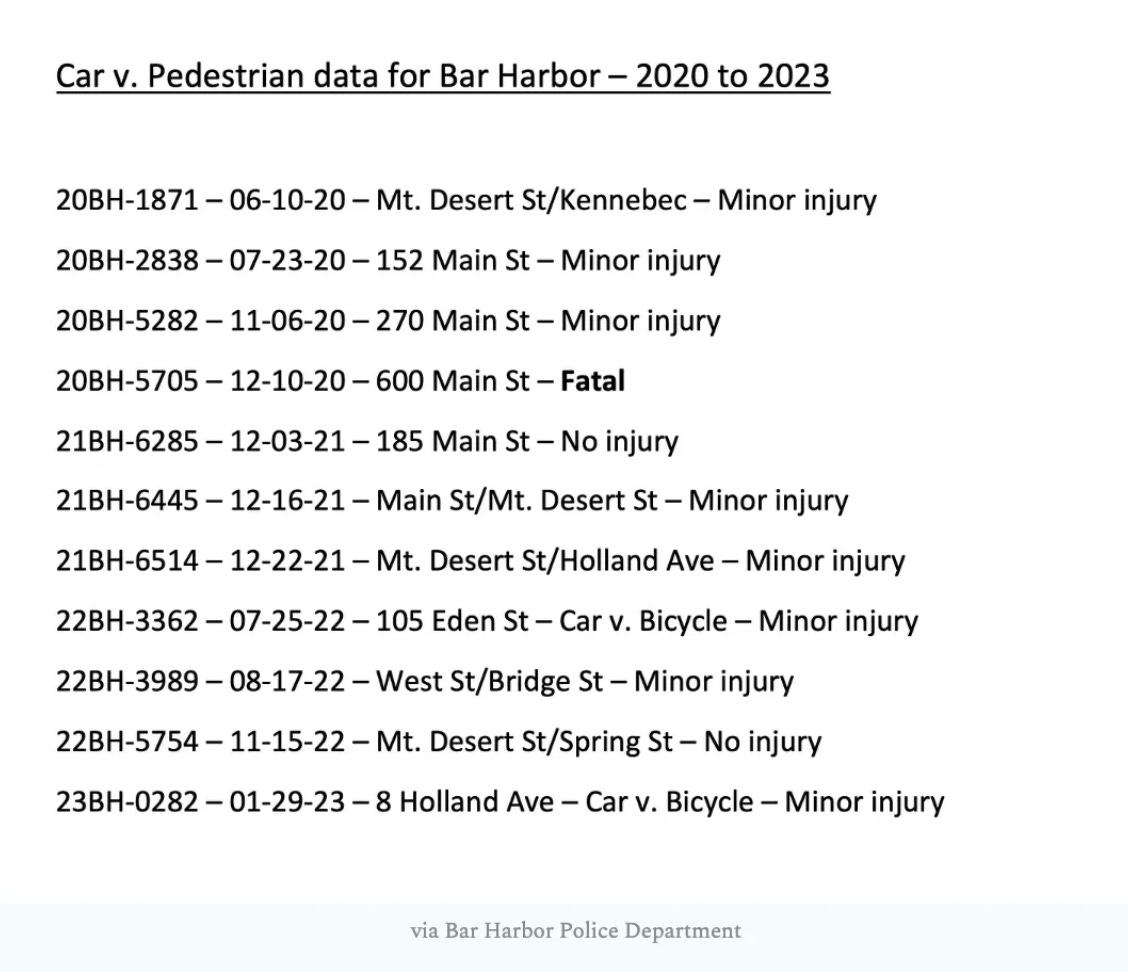
According to former Police Chief Jim Willis, between 2020 and 2023, there have been 11 car and pedestrian incidents in Bar Harbor. Eight resulted in minor injuries, one was fatal, and two resulted in no injury. Of those, two involved car and bicycles.
Five occurred on Main Street. Four occurred on Mt. Desert Street.
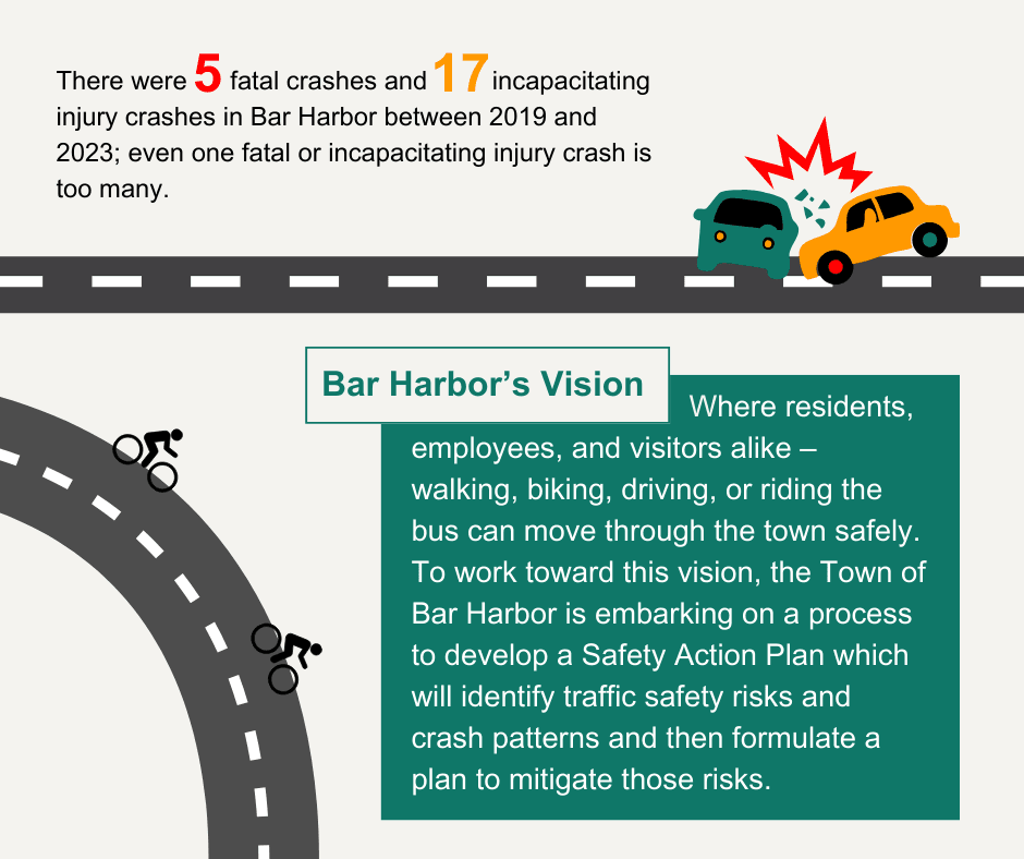
In the last four years in Bar Harbor, there were five fatal crashes and 17 crashes that caused incapacitating injuries.
The town received the Safe Streets for All Planning Grant in 2022, which awarded the town with over $200,000 to support the creation of a Transportation Safety Action Plan. The town has contracted with Stantec to assist with the Safety Action Plan creation process.
The project is funded by the United State Department of Transportation. There’s a national push to reduce series injury and fatal crashes. The goal is to collect the data, create a draft plan, present it to the public, and then use that plan to create changes that will make those walking, driving, biking, skateboarding, and scootering on the streets safer.
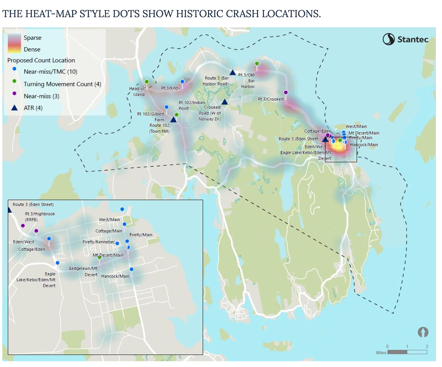
This summer Bondy and her team tried to capture close-call crashes. In early September, they reached out to the public. They also conducted near-miss analyses at 13 locations.
“We have gathered a lot of information,” Senior Transportation Engineer Paul Pottle, who is also a Bar Harbor resident, said while presenting with Bondy at the Tuesday Council meeting.
A young woman was killed in December 2020 while in a crosswalk at the Jackson Lab, another woman was killed in 2017 in the parking lot of the Chart Room. Other pedestrian and vehicle interactions with varying levels of injuries have occurred on Mount Desert Street and Eden Street and other Bar Harbor locations.
The grant is part of the bipartisan infrastructure law that sent more than $800,000 for four Maine projects. The pedestrian safety grant was part of Bar Harbor’s “Safe Streets for All” federal funding request to help secure a regional comprehensive transportation action plan. That grant is not connected to the Jackson Lab’s own street calming project on Route 3.
“There are going to be a whole bunch of solutions that are proposed,” Pottle said.
Councilor Maya Caines said she was excited about the project and wondered how it aligns with the town’s streetscape projects.
Public Works Director Bethany Leavitt said that the town is currently using the land use ordinance and current standards as a guide for the Main Street streetscaping. As her department moves onto the Cottage Street streetscaping, the Safe Streets feedback can help guide decisions. The Cottage Street plan will have a two-year design period.
Caines also suggested communicating with Malvern Belmont residents and other high density housing locations about their needs and concerns.
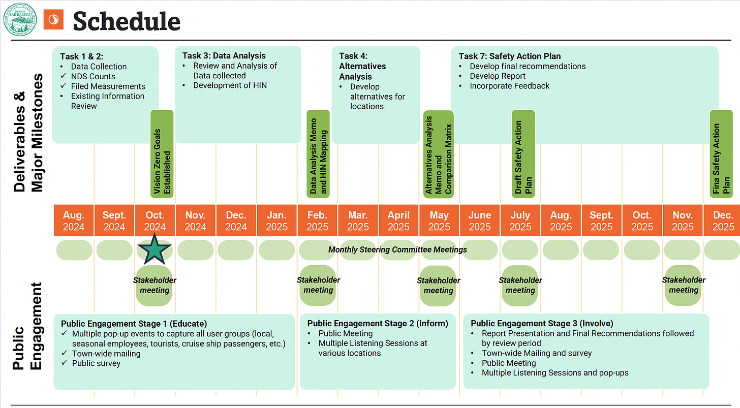
There will be a draft plan in the spring and a final round of presentations and engagements in the summer with the goal of adopting the plan by the end of next year.
Both Councilor Joe Minutolo and Vice Chair Gary Friendmann spoke to concerns about the traffic coming on and off of the island as well as the safety of bicyclists on the streets of both Bar Harbor and Acadia National Park.
OTHER BUSINESS
The Bar Harbor Town Council also appointed Eliza Oldach and Catrina Spruce to the Task Force on the Climate Emergency. Their terms end in 2027. April Nugent was appointed to the Conservation Commission with a term expiring in 2027.
LINKS TO LEARN MORE
Please fill out this survey to share your experience on the roadways in Bar Harbor. link here
There is a GIS Map available for you to share specific locations and intersections around town. link here
Town’s Safe Streets for All page
If you’d like to donate to help support us, you can, but no pressure! Just click here.
If you’d like to sponsor the Bar Harbor Story, you can! Learn more here.


