Planning Board Visits Brigadoon
Neighbors and Planning Board members walk potential housing subdivision site
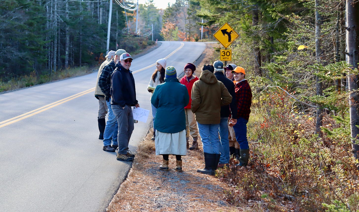
BAR HARBOR––Thirteen members of the community, Bar Harbor Planning Board, and planning department met on the Crooked Road, November 2, to walk the 179.21 acres of the proposed Brigadoon Acres Subdivision. The property is the only housing subdivision before the board.
Four abutting property owners, Barbara Tennent of Frenchman’s Hill Road, Daniel Tandy of Blackwatch Trail, Laureen Donnelly of Crooked Road, and Cynthia Ocel of Fern Meadow Drive walked the rugged property, or as much of it as they could.
Planning Board Chair Millard Dority, Vice Chair Ruth Eveland, Secretary Elissa Chesler, member J. Clark Stivers, Staff Planner Cali Martinez, Deputy Code Enforcement Officer Mike Gurtler, Patrick Lyons from the developer’s legal firm, Eaton Peabody, Michael Good, and Project Manager Perry Moore all walked the property that’s slated to potentially house a new subdivision.
The property line for the proposed subdivision starts just west of Fern Meadow Drive, across the Crooked Road and runs 1675 feet to the east, just beyond the first northerly curve in the Crooked Road and very close to Gemstone Way. Denise Carey Bettencourt and her husband Christopher Bettencourt currently own the property and hope to develop it for housing.

There are a proposed 14 lots total with five of those lots having frontage on the Crooked Road. Only one lot, lot five, would have driveway access directly off the Crooked Road. Three of the other lots would be accessed from the road that is proposed to be put in off the Crooked Road. The remaining lot that has frontage on the Crooked Road, lot one, would be accessed by a right of way from lot two.
The proposed access road, which a portion of is planned to eventually meet the standards of the town to be a town road, will be between lots two and three and is directly across the Crooked Road from Folkestone Drive.
The plan is to build the road in three stages with the second and third stages ending in a cul-de-sac. The first stage of the road will be approximately 600 feet long and will end with a firetruck turnaround. The second stage will be approximately 900 feet long and will end with a cul-de-sac. This first cul-de-sac will be the end of the proposed town approved portion of the road. The third and final stage will be approximately 2750 feet long and also end in a cul-de-sac. The total road length will be approximately 4250 feet, not counting the space taken up by the cul-de-sacs. There will also be an additional driveway off of the second cul-de-sac to access lot 14 that will be just over 400 feet long.
From the most westerly point of the property on the Crooked Road to the center of the proposed access road is 550 feet. From that centerline to the most easterly point of the property on the Crooked Road is 1125 feet. The portion of the road to be accepted by the Town would be two 10-foot lanes with two-foot shoulders on each side (24’ wide) in a 60-foot right of way (ROW). The remainder would be the same road width but in a 50-foot ROW.

The road cannot be accessed from the far end due to preservation lands owned by Maine Coast Heritage Trust and topographic features. For this reason, they do expect to provide some sort of water storage structure whether it be a pond, tank, or cistern for fire safety. The storage system could potentially benefit more than just residents of the subdivision because other than the pond at Frenchman’s Hill, there are not a lot of water storage systems in the area. The residences constructed will be required to have residential fire sprinkler systems installed as well.
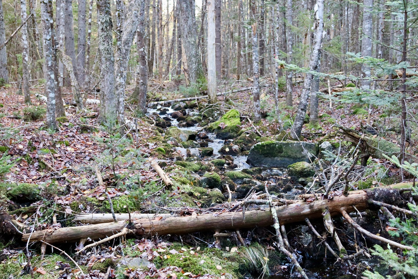
During the walk, which was not quite half of the property, the attendees could see that the land types vary significantly and there may be wildlife that utilizes this land for different aspects of life, but besides deer scat and one nearby sounding by a Barred Owl (which was identified by attendee Michael Good), there was not much immediate evidence of heavy usage by wildlife. Almost the entirety of the property was decimated by the 1947 fire and it does not seem to support many old growth trees.
Because of regulated streams, wetlands, and vernal pools (which have sizeable buffer zones), the ecology is protected to the extent required by the appropriate regulators, such as the Maine Department of Environmental Protection and the Army Corp of Engineers. These protections do not leave an enormous amount of area for residences and associated infrastructure like wells and septic systems. But those areas are there and available for new housing opportunities.
INFORMATION SESSION AT TOWN HILL COMMUNITY HALL
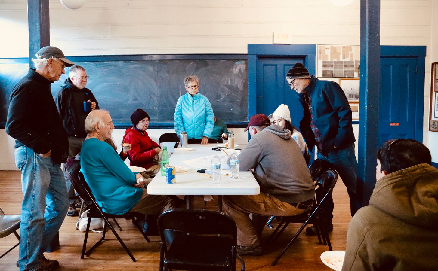
After walking as much of the property that could be fit in the allotted time, the attendees were invited to attend a sit-down informational session at the Town Hill Community Hall. The attendees were the same at the meeting as at the walk thru except Stivers and Gurtler; both had prior obligations that prohibited them from attending. The information session group did gain two new attendees, abutter Robert Jacobson of Frenchman’s Hill West and Diane Vreeland of Indian Point Road.
Dority started off the meeting by telling the audience that this was not the public’s last opportunity to make comment as there are still at least two more Planning Board meetings to be held on this project.
Vreeland started off the questions by asking Moore where the driveway into the project was located and what the sight distance was for the driveway. She then stated that she saw a map somewhere showing that this property was in the flood zone. “Is that not true?” she asked.
Moore responded that the driveway is located directly across from Folkestone Drive and the sight distance will be in the final report submitted to the Planning Board. To the flood zone question, Moore said, “Portions of the site are in flood zone, yes. But only at Aunt Betty’s Brook.”
Vreeland also said, “Over the years, things change. When you do this, is that a topographical aerial view of wetlands? How is this noted? Because, we are seeing things, with climate change, change a lot. Do you just copy this from another map, or who puts those (wetlands) in those places?”
“The wetlands were delineated in the field by wetlands scientists over the past three years.” Moore said.
“Over the past three years? So, you just copy that?” Vreeland clarified.
Moore said, “No. That is actually generated limit of the wetlands as they exist today on the face of the earth. It was not on a map until we made it. That is original information.”
Good then asked when the road would be extended all of the way to the back of the property. “Are you going to wait until you have sold those lots?” he asked.
Moore explained that is something that they still need to negotiate with the Planning Board. “Currently, discussion with the client is that we would do phase one, which will allow access to lots one, two, three, four, and five.”
“What I am encouraging the owner to do is to build spec houses, because the big issue for people to get into housing is not just buying land, it’s buying a house,” said Moore. “I am encouraging him to drill the wells, build the septics, build the driveway, and put in what we call ‘Home Depot ready’ homes.”
Moore went on to explain that this would likely be a modular home that has been plumbed, wired, primed, and ready for the homebuyer to add their personal touches in fixtures, paint, appliances, etc. while cutting down on costs with sweat equity if they choose to do so. This cuts down on many of the headaches that homebuyers encounter when starting with a bare lot, and with having to find contractors, jumping through all of the approval hoops, and watching the expenses pile up.
Moore said that hopefully, building spec houses will enable the developer to build and sell them quickly and efficiently. The plan is to start phase one and then do a couple of layers of permitting with the DEP and Army Corps of Engineers in regard to storm waters, vernal pool buffers, and the stream crossings which will hopefully get completed while phase one is being built and sold. Moore said this should take a year or two.
After those approvals from the state, they would do phase two of the road which would be to the first cul-de-sac and would allow access to lots six, seven, and eight. The third and final phase of the road, which is from the first cul-de-sac to the last cul-de-sac, would be dependent upon how fast the first two phases close out. The third phase will likely, but not positively, be higher end houses.
Moore said, “If I could make this happen like I would like to see it happen, phase one would start next spring. That’s the road and one of the lots for a house to be sold and then over the course of the next year or so, build out those that don’t sell to people that know they want to build their own houses, then maybe after those sell, I would say maybe in three years they are all sold, do phase two. So, I could see phase three starting about five years from today and I would guess we are looking at 2028 to 2030 for that (the road) being finished. If that’s amenable to all of the players.”
Good asked if there was any way that the developer would consider not developing lots six and eight. Both Good and Vreeland said that they would feel a lot better about the entire project if those two lots could be set aside and not developed.
Moore said that he has already pared the number of sellable and buildable lots down as far as he thinks that he can get with the developer and that he doesn’t foresee any proposed lots being removed from the plan at this time.
Tennent asked about the open space lot and what the purpose of it was all about and if the owner would retain that lot or if it would be owned in common.
Moore said that it has not yet been determined, but there is a provision in Bar Harbor’s Land Use Ordinance for subdivision developers to set aside “something like five percent” of the land as open space. On this project, Moore said that he is proposing about seven percent of the land for open space.
There was a large amount of conversation about ecology, biodiversity, and animal habitat and corridors before Dority stepped in by asking Good if he was involved in the Comprehensive Plan planning process because that is the place to make the kind of changes that could be environmentally impactful.
Dority said, “There is no avenue for us (the Planning Board) to discuss these things. As long as they meet the requirements of the land use, that makes it difficult for us.”
Chesler said to Good, “That’s the problem. Once it comes down to this property and this project, we are limited to evaluating whether it meets the standards of the ordinance. What you are proposing or discussing are potential changes to the ordinance which have to flow from the comprehensive plan.”
“Our ordinance has requirements; we are going to meet the ordinance requirements. The DEP has requirements; we are going to meet the DEP requirements. The Army Corps (of Engineers) has requirements; we are going to meet the Army Corps requirements,” Moore said. He also said that so far, they have done this project with less than 5,000 square feet of wetland alteration.
Donnelly said that her main concern was the waterflow over and through the land. She asked, “How would the road cross the brook(s)?”
The road will eventually make three crossings of regulated streams and Moore said that they would build concrete abutments that run parallel to the brooks and then build an arch bridge on top of the abutments, essentially a concrete culvert with an open bottom.
An attendee asked about lighting and stated that she loves the dark skies. Moore responded that neither he nor the developer have plans at this time to put any streetlights in but there are night sky requirements in the Bar Harbor ordinance anyway.
Jacobson said that the only thing that he noticed that was of a concern to him was how the access road juts in close to his property on Frenchman’s Hill. Moore explained that because of the large expanse of wetlands in that area, the two stream crossings closer to Jacobson’s property are the only real spot for the road to go through. Moore also explained that due to setback requirements, the placement of the road would likely ensure that any homes built in that area would actually have to be further away from Jacobson’s property.
Moore said that the feeling that he was picking up from the actual abutting neighbors is that they would be happiest with a slower overall project timeline. He told the members of the Planning Board that were present that he was going to come before them and asked for a phased development approval. This would allow them to have an approved subdivision but with further conditions that have to be met before moving beyond phase one of the road construction. The conditional approvals would be the storm water permits and approval of the stream crossings from the DEP and Army Corps of Engineers.
AFFORDABLE HOUSING QUESTIONS
One of the final questions was from Tennent who asked if any of the houses would be considered affordable housing.
Moore said that while none of the houses will be deeded as affordable or have any requirements that need to be met to purchase them, the intent of the smaller lots that front the Crooked Road and his idea of building the “Home Depot ready” spec houses is to make them as affordable as possible.
The only project in Bar Harbor that is currently before the Planning Board is this subdivision, Brigadoon.
“There is no question that the cost of construction is definitely having an effect,” Dority said at another Planning Board meeting last week. That meeting was held a day before the site visit.
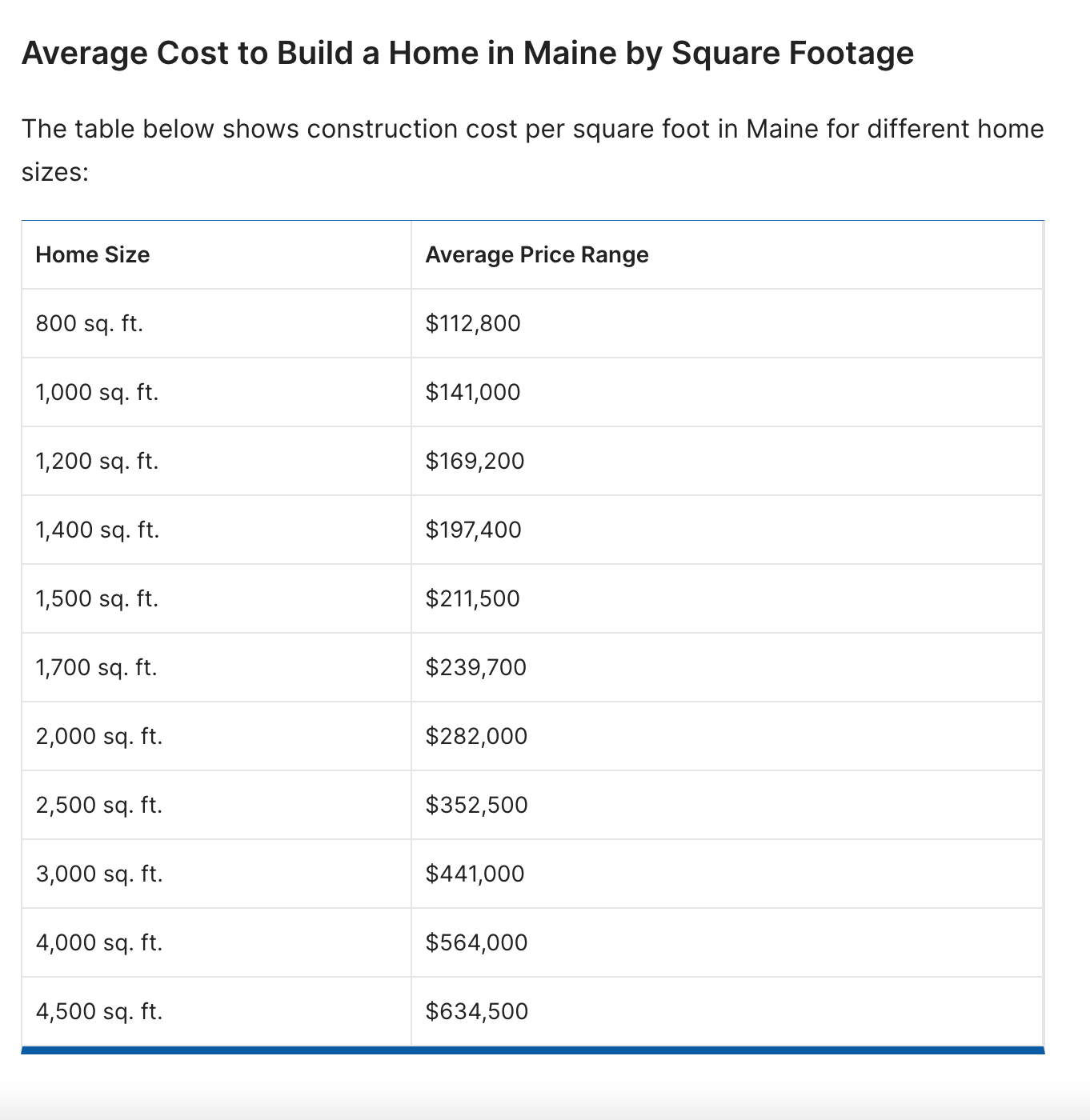
The cost to build a home or homes in Maine is impacted by high labor costs, issues with the supply chain, rising material costs, development and approval fees and process, as well as land price. According to U.S. census data, Maine has issued less and less building permits for homes. There were 6,500 permits issued in 2021. As of September 2023, there have been 4,675 home building permits (all unit sizes) issued in Maine. Most of those are single family homes (3,440).
HOUSING NEEDS
Bar Harbor’s population has increased from 4,820 in 2000 to 5.527 in 2020. It’s projected that by 2038, it will have more than 6,000 residents, an increase of 15%.
It’s estimated that Bar Harbor needs over 600 housing units by 2033.
Photos: Shaun Farrar
LINKS TO LEARN MORE
Sketch plan application (submitted 09.07.2023 and revised on 09.25.2023)
https://barharborstory.substack.com/p/new-proposed-development-hopes-to
https://www.census.gov/construction/bps/statemonthly.html
https://www.houzeo.com/blog/how-much-does-it-cost-to-build-a-house-maine/


