Satellite Parking Not Allowed at Future Marina?
Harbor Committee Discusses Plans at Ferry Site
BAR HARBOR— The Harbor Committee met with Travis Pryor, a representative of GEI, the consulting firm helping the town with plans for 121 Eden Street in a Zoom meeting on Monday, April 17 to hear a bit about the progress in creating a master plan for the location.
Three members of the 11-member committee attended the meeting, which had been scheduled last week. Those included Chair Jeff Miller and Harbor Committee members Robert Garland and Kaitlyn Mullen. Garland was there despite heading into surgery on his ankle the next morning.
Harbormaster Christopher Wharff, Council Chair Valerie Peacock, and Warrant Committee member Carol Chappell also attended. Peacock and Chappell attended as members of the public.
“This is all about you, Travis,” Miller said at the beginning of the meeting.
Pryor led the meeting and is the lead engineer with GEI. He has been working on gathering stakeholder input about the project and said he’d spoken to five members of the committee so far. The organization did a structural analysis of the pier a few years ago. Then the town applied for a Maine Coastal Program grant to create a master plan for the project. That Maine Coastal Program grant has helped fund the plan, which Pryor expects will be completed by the end of 2023. The next few months will involve more public interaction, he said.
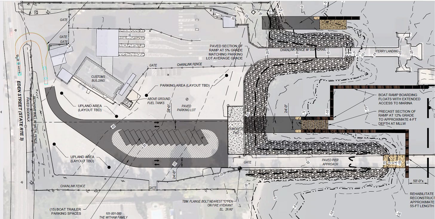
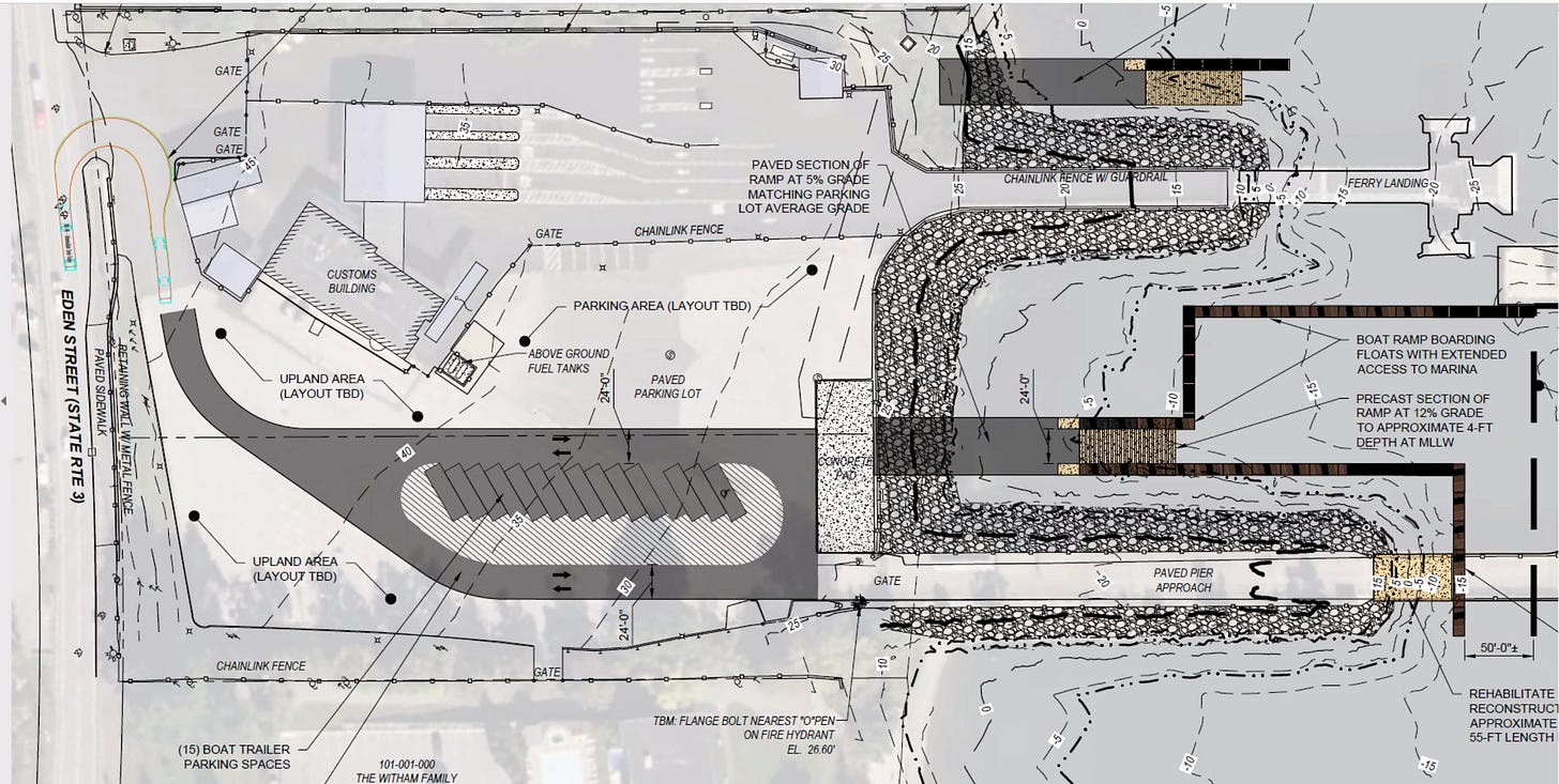
The plans divide the site with existing ferry operations to the north, and could involve the demolition of some of if not all of the currently existing concrete piers, developing some marina space and a boat launch that would be accessible at all tides.
One of the ideas is to run boarding floats to the south of a proposed boat ramp. There are some worries about ingress into the location for vehicles hauling trailers and larger trucks. The issue is the location of the customs building.
Initial plans had 15 boat trailer parking spaces with one ADA boat trailer parking space. An alternative had a boat ramp to the south of an existing pier. That would require an agreement with the neighboring property owner. A boat launch on the north side would not be as protected from fetches coming across the bay.
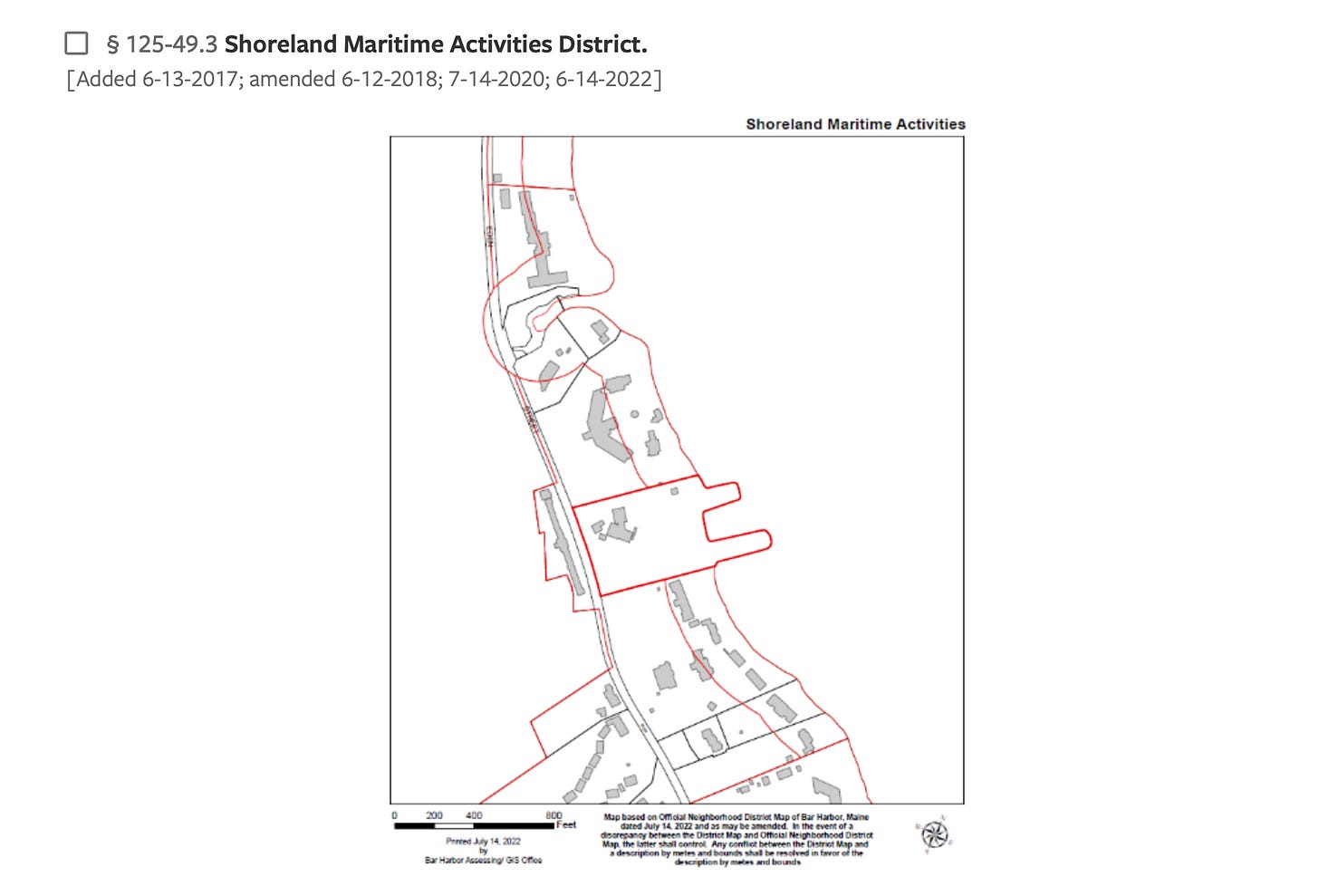
During the meeting, Chappell said that the site is in the shoreline maritime activities district and that the town’s zoning says that any parking has to be accessory to use.
Satellite parking to help alleviate the town’s parking congestion has often been mentioned in relation to the site. In a June 20, 2021 letter to the members of the committee and the Town Council, Arthur Grief raised legal concerns about parking as a “primary use” at the town-owned lot writing,
State guidelines from the Department of Environmental Protection have also spoken to the specific uses in a shoreland zone.
The committee didn’t delve into the issue at the meeting. Members and Pryor and Peacock discussed the potential site of a proposed boat ramp; whether or not the entrance to the site had an adequate turn radius for larger trucks and trucks with trailers (it was modelled for a 40-foot truck); whether the pier could support the weight of box trucks and oil trucks; and if the boat ramp should be doubled in width to accommodate two users at once.
Miller asked if the current pilings required a rebuild to handle the equipment. Pryor believes that they would require some rehabilitation and is asking a colleague if the structure needs additional bracing or piles.
“Everything is going to be fairly expensive to construct,” Pryor said. It could costs tens of millions of dollars at the biggest build out. Miller said he’d like to know the cost to have the ramp wider. The ramp as sited on the current potential plan has a 12% grade and requires some fill below it.
He said in his discussion with stakeholders that there wasn’t interest so far in retail on the site. There was some interest in education and parking.
“A lot is up in the air pending what you guys want to do with the ferry service going forward,” he added. Cruise ships also add to the questions about the site’s potential uses.
The group talked about the viability of the future of the ferry service currently provided by Bay Ferries with the CAT, with Pryor wondering if the site will continue to be used by a vessel as big as the CAT or be something smaller like Diver Ed’s tours. Ed Monat was not at the meeting. He is a member of the committee.
Garland said his own interest since the beginning has been about mooring cruise ship tenders in that area. Providing income from the tender vessels has always been a part of the plan, he said. He hasn’t received a lot of support for it, he said, but it’s still on his plate when he thinks about the site.
“The question of Bay Ferries is a very real one,” Garland said. Bay Ferries’ use impacts the security zone and the northern pier. Without the ferry, there wouldn’t be ingress worries.
The town has four more years of a lease with Bay Ferries, Peacock said.
The group asked for a plan both with and without Bay Ferries at the site.
Wharff said that it was hard to figure out demand for a boat ramp at the new site compared to what is happening currently at the town wharf. The same goes for demand for slips. Stakeholder feedback so far has focused on the ramp and slips when he’s communicated with people. Most of those who he’s talked to weren’t that interested in refueling abilities at the location, he said.
At the committee’s May 8 meeting, Pryor will discuss the potential plan more with the members. This meeting will also be open to the public.
This summer he intends to refine the concept plans (with and without Bay Ferries). Pryor asked Peacock if the conceptual plans can be put up on the town’s website. She said it could and also suggested that an information and feedback table could be put out for town meeting and the election in June. She also suggested using the survey site PolCo for soliciting the public’s input.
LINKS TO LEARN MORE
Chapter 1000: GUIDELINES FOR MUNICIPAL SHORELAND ZONING ORDINANCES
https://www.barharbormaine.gov/275/Harbor-Committee


