


Tonight's Storm Could Impact Mount Desert Island Region


MOUNT DESERT ISLAND—High winds could blow across much of Maine between 7 p.m. tonight and 7 a.m. Thursday, the National Weather Service warned, December 11.
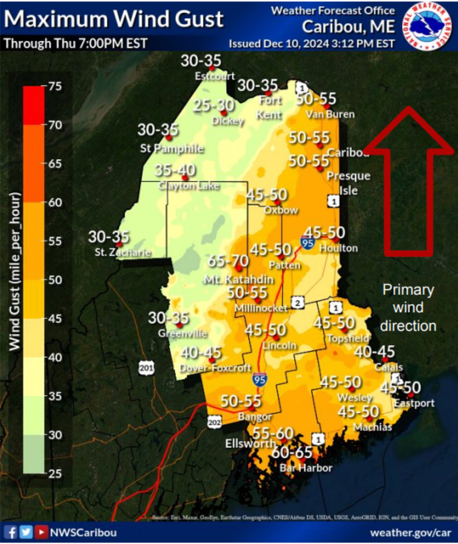
The winds from the south are expected to be sustained between 20 and 30 m.p.h. Gusts on Mount Desert Island are expected to reach up to 60-65 mph, with some potential for higher gusts according to the National Weather Service’s Caribou office. Ellsworth may have gusts from 55-60.

Predicted rain amounts vary throughout the state with heavier rain expected inland. Warming temperatures are also likely to cause recent snow to melt, which may produce flooding in areas throughout the state. Power outages are also likely.
An update at noon, December 11, reads, “Damaging winds will blow down trees and power lines. Widespread power outages are expected. Travel will be difficult, especially for high profile vehicles.”
Water vapor creating an atmospheric river effect such as this storm has the potential to create a “bomb cyclone” and severe rain at times, according to the Associated Press.
Just yesterday, MEMA issued guidance about public assistance (PA) and individual assistance (IA) programs related to storms. The flood watch is in effect from noon, December 11 to 10 a.m. December 12. The high wind warning is in effect from December 11, 7 p.m. to December 12, 6 a.m.
High tide in Bar Harbor is at 7:02 p.m. tonight and 7:26 a.m. tomorrow morning.
Power outages to Versant can be reported via its Online Outage Report Form or by calling (207) 973-2000 or 1-855-363-7211 (1-855-363-7211).
If you’d like to donate to help support us, you can, but no pressure! Just click here (about how you can give) or here (a direct link), which is the same as the button below.
If you’d like to sponsor the Bar Harbor Story, you can! Learn more here.