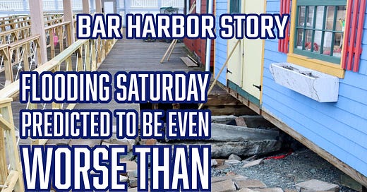
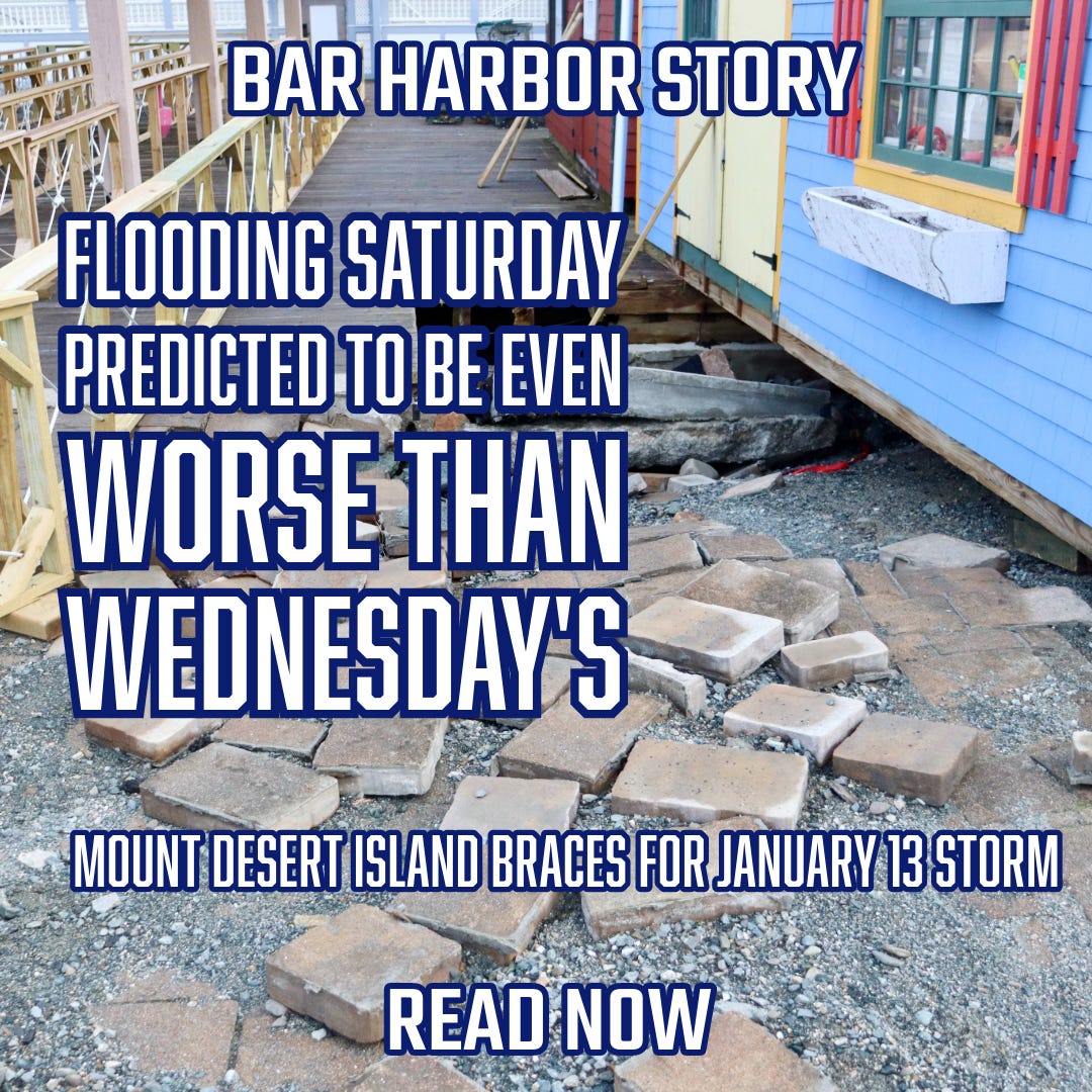
Flooding Saturday Predicted to Be Even Worse Than Wednesday's
Mount Desert Island Braces for January 13 Storm
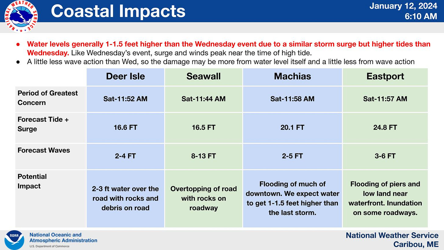
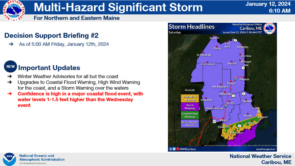
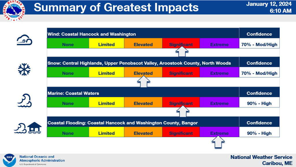
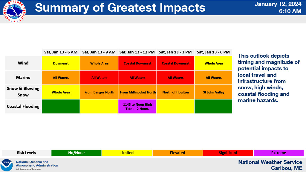
BAR HARBOR—The National Weather Service is expecting storm surge and the winter’s highest tide to combine for flooding on Maine’s coast.
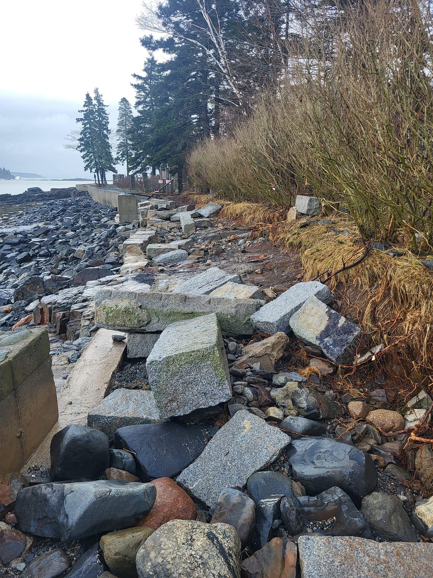
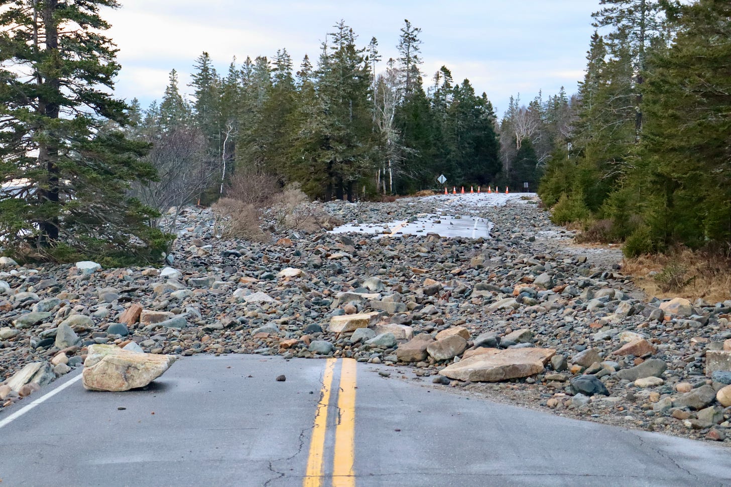
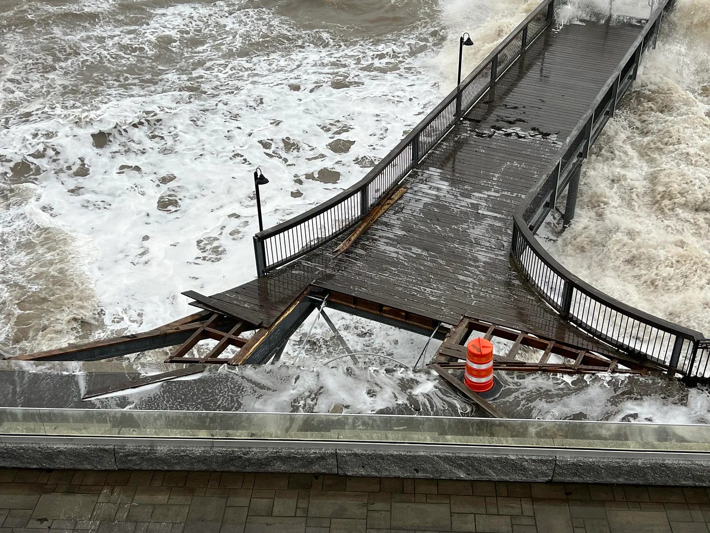
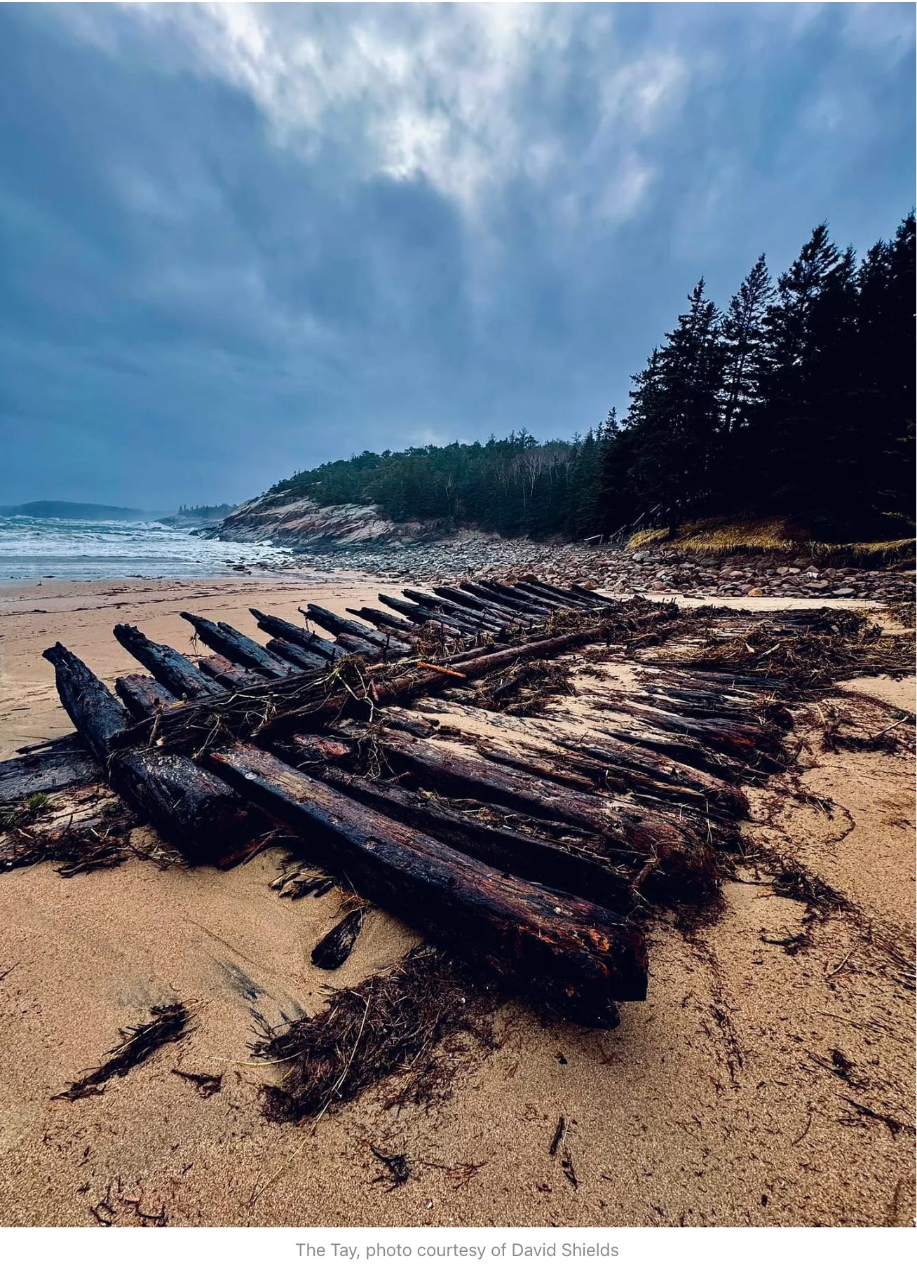
Near to 4.5 feet of storm surge will combine with a midday high tide, which may create water levels of a foot higher than the storm that brought devastation throughout the island and Maine on Wednesday. That storm caused flooding and damage along coastal roads, demolished large sections of Bar Harbor’s beloved Shore Path and damaged piers along West Street, including the town’s wharf.
“High tides, heavy surf and wind-swept waves could make the coast extremely dangerous. For their safety we urge citizens to stay away from the coastline during this significant storm,” said MEMA Director Peter Rogers. “Coastal residents need to make plans now for flooding, possible road closures, and always follow guidance from local officials.”
The potential flooding may be the worst in the last ten years, particularly because municipalities, land owners, and the state haven’t had sufficient time to rebuild or repair roads, docks, buildings, berms, sand dunes and other defenses against water that rises.
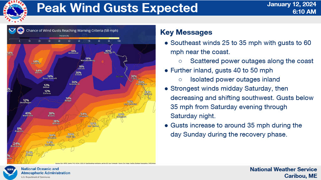
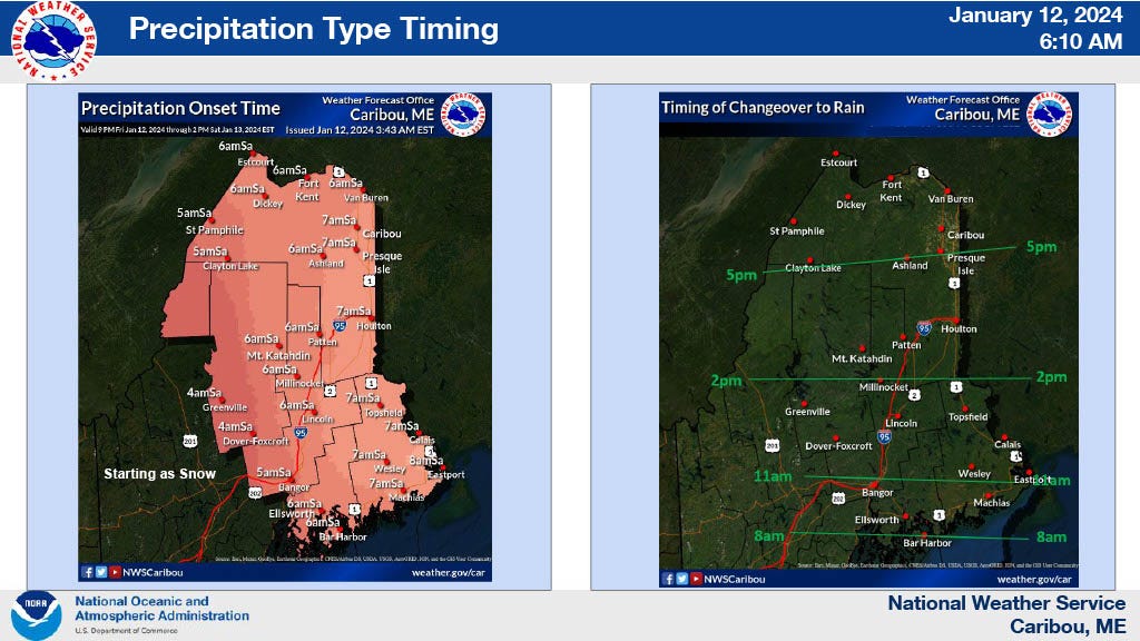
Maine Emergency Management Agency (MEMA) is urging people to stay away from the coast during the storm that arrives this evening and will continue through much of tomorrow. Residents, especially those near the coast, should make a plan, have multiple ways to receive emergency alerts, be familiar with evacuation routes, and follow guidance from local officials.
“I strongly urge Maine people, particularly those along the coast, to take this storm seriously, to prepare for it, and to follow the advice of local emergency management officials,” said Governor Janet Mills. “We are encouraging people to stay away from the coast if possible. While the storm surge will likely be smaller than earlier this week, we are expecting a larger swing in the tides which means that folks should expect serious flooding again. With high winds, there is also the likelihood of power outages. MEMA’s Emergency Operations Center will be at full activation tomorrow, and we will continue to monitor the storm’s impacts and respond accordingly. Please do your part by preparing and taking precautions to stay safe. Remember, it is never safe to walk through flowing water, drive through flooded areas, or drive around road barriers.”
ONLINE PORTALS FOR DAMAGE
Always report damage to your insurance company.
To report damage to private industry and commercial infrastructure https://survey123.arcgis.com/share/f72826c1e40d4420ad89934b553c0e82
At your home: https://survey123.arcgis.com/share/9d30851ba5e448fbb099592ed09e31cc).
More information: https://www.maine.gov/governor/mills/flood.
OTHER LINKS
Versant Power and Restoration Maps
National Weather Service - Gray Maine - Facebook
NOTE FROM US AT THE BAR HARBOR STORY
As most of you know, we live here in Bar Harbor, too, and if the storm does, indeed, cause historic flooding, we’ll do our best to cover it.
We’ll likely post more often tomorrow (Saturday) via our Facebook page so that your inbox isn’t inundated with emails from us. Because of that same reason, we currently have a backlog of stories (we didn’t want to send three emails a day), and hope that you’ll understand that we’re still posting completed stories about town government meetings from last week.
Please stay safe if you’re in a coastal area—or any area, and please know that we are here with you. If you have images that you’d like to share, or questions you have, you can email us here or on Facebook or Instagram.
“Massive destruction on a proportion never seen”
BAR HARBOR—Bar Harbor’s famous Shore Path is closed. After significant damage to the path in yesterday’s mammoth storm, the path has been cordoned off to protect the public and prevent further erosion. Wednesday’s storm brought gusts of over 75 mph in the Down East region,
Storm Smashes Into MDI
BAR HARBOR—High winds and high tide have combined to cause damage throughout Mount Desert Island today, January 10. High tide was shortly before 9:30 a.m. The Bar Harbor Inn’s pier has taken on significant destruction and General Manager Jeremy Dougherty suggests people avoid the Shore Path from Grant Park to the town pier. The below images and video is …


