BAR HARBOR—Bar Harbor’s famous Shore Path is closed.
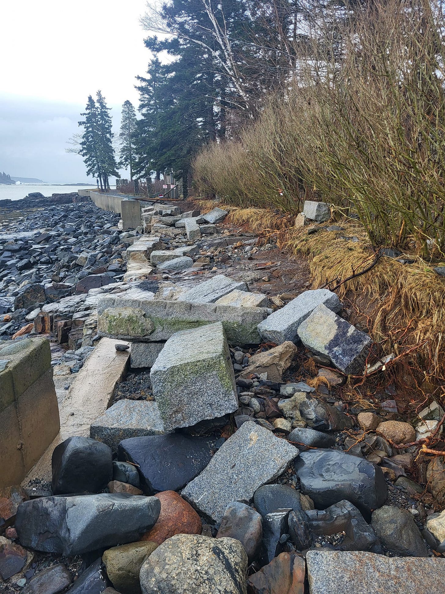
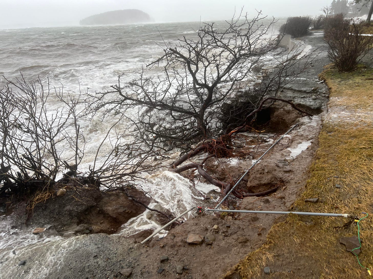
After significant damage to the path in yesterday’s mammoth storm, the path has been cordoned off to protect the public and prevent further erosion. Wednesday’s storm brought gusts of over 75 mph in the Down East region, moved a camp out to sea, and caused damage to multiple roads and structures throughout Mount Desert Island. It also left more than 14,000 Versant customers without electricity.
Its impact in Bar Harbor was heavily felt with some still assessing damages today.
“This is massive destruction on a proportion never seen before on the Shore Path in my lifetime,” said Bar Harbor Village Improvement Association President Dickie Cough. “It will take more money than we have to repair it all, so we will need to start raising money immediately.”
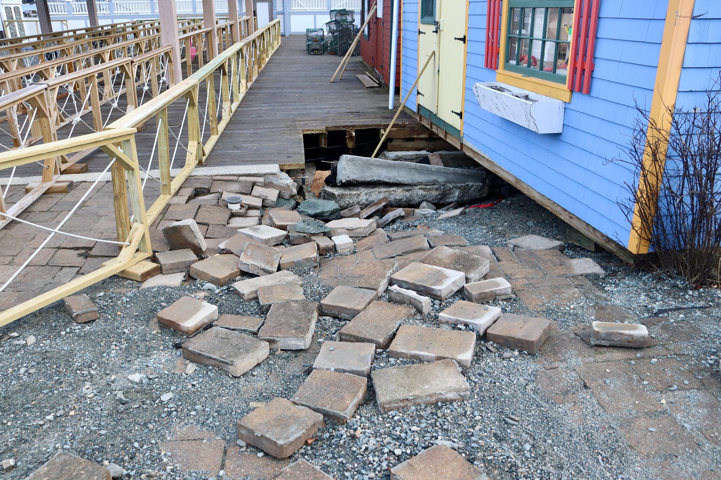
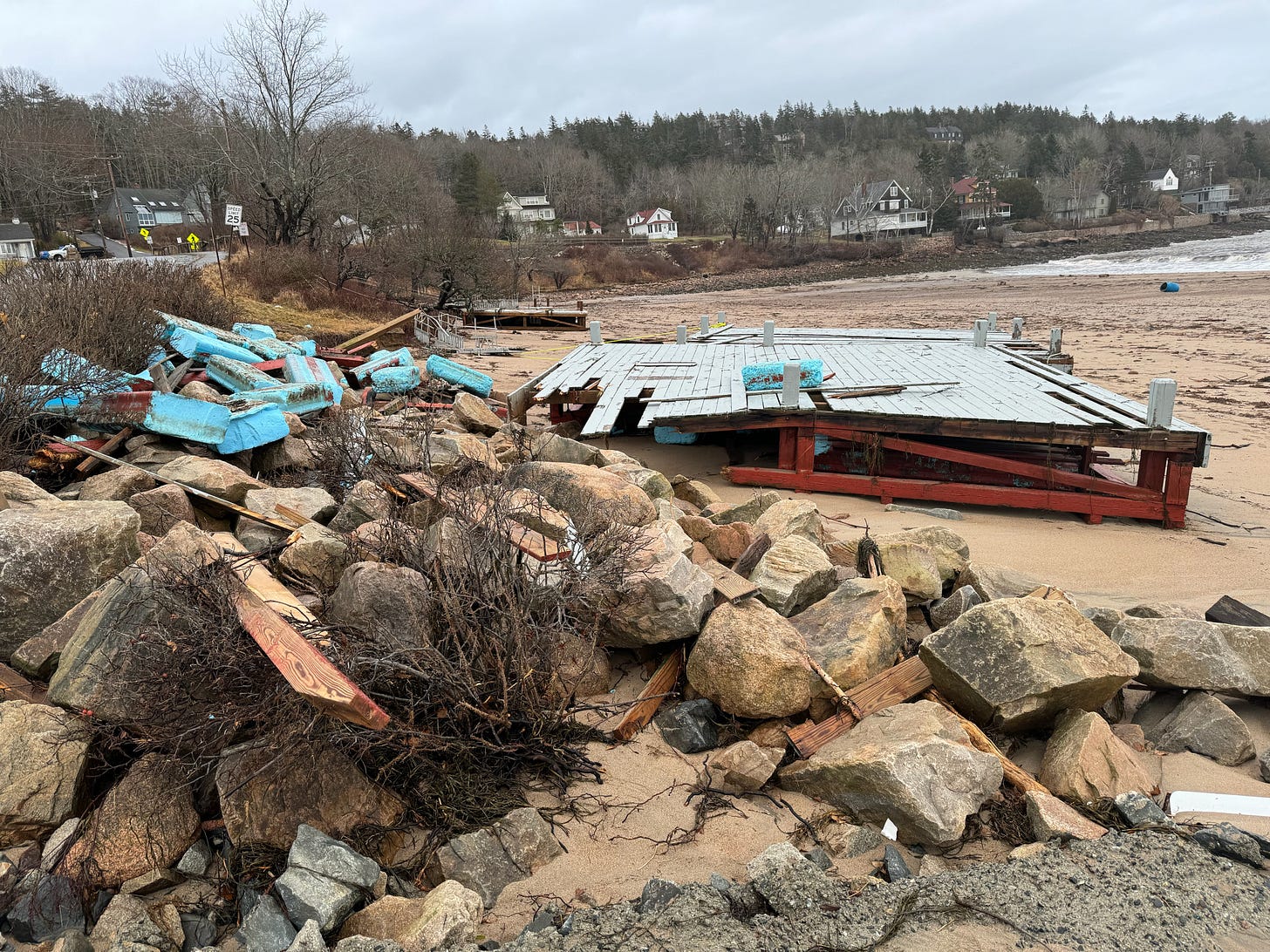
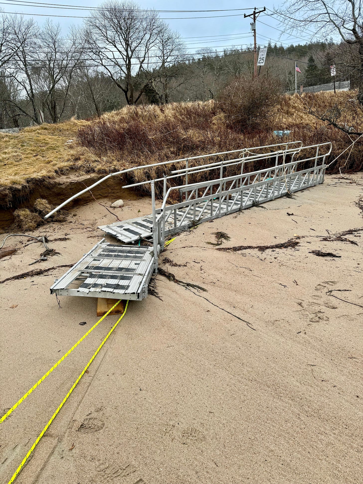
Massive portions of the path no longer exist. Nearby, the Bar Harbor Inn’s pier has a gawping hole in it. Damage to the Harborside Hotel and cruise ship tendering area and shops was also readily apparent as business owners assess damages.
video courtesy West Street Cafe
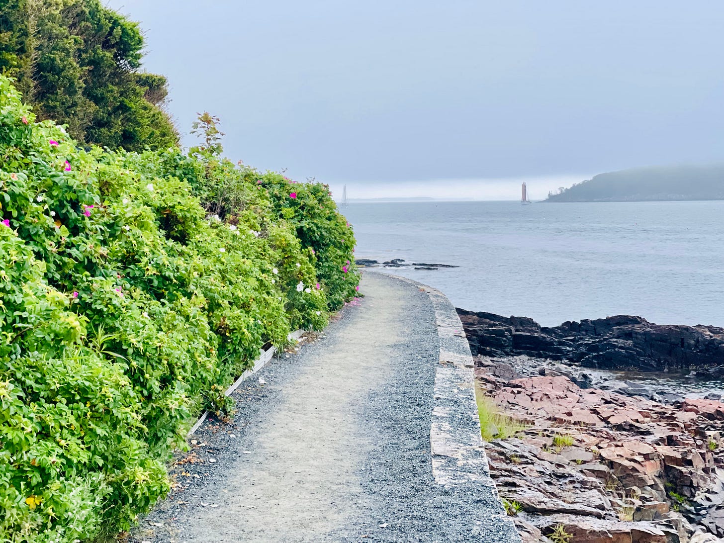
But the Shore Path is a different beast. It’s part of Bar Harbor’s lure and its history. Less than a mile long one way, it’s a staple for visitors and a major place of vacation photos and memories.
The Bar Harbor Village Improvement Association keeps the publicly accessible path clean and groomed so that people can visit Frenchman’s Bay without leaving the land. The Shore Path begins at the Bar Harbor Inn or the town’s Ells Pier and ends at Wayman Lane. Different property holders own different portions of the path.
According to the association’s website,
”This lovely walking path was made possible by the VIA working with the landowners who generously sacrificed their privacy so the public could enjoy this amazing walk. In return, the VIA accepts the responsibility and costs for maintaining the path and seawall improvements. Please do respect their property and privacy while enjoying this gem.
”The Shore Path dates to 1880. The VIA has made significant improvements to the gravel surface and stone retaining walls. We also added stone benches in 2012 and historic informational panels in 2013. The section of path between Agamont Park and Grant Park was recently widened from three feet to six feet to better accommodate current foot traffic.”
Throughout the year, tourists and locals stroll and saunter around a little point of land and past the inn along a gravel path that hugs the coast line. Toward town in the spring, there will be wild roses, fences on private property in various states of repair.
“This is the fourth damaging storm this winter and we've already talked with Harold MacQuinn Inc. about assessing the damage and prioritizing repairs,” Cough said. “Weather will play a role as to when major repairs can get started, as it will be necessary to replace entire sections of seawall. It’s also apparent the existing height of the seawall is no longer sufficient to keep the storms off the path so that must be addressed, too.”
“The path is closed until further notice ,” Cough said.
The organization’s board issued the following statement:
“The Bar Harbor Shore Path is on land that is privately owned by the abutting landowners. They have for years generously allowed the use of their land. The Shore Path is maintained by the Bar Harbor Village Improvement Association.
“In light of today’s storm and the significant damage which has occurred to the shore path from the Bar Harbor Inn to Wayman Lane, and with consideration to public safety, the BHVIA has closed all access points, from the Town Pier, from Grant Park and from Hancock Street and Wayman Lane.
“We would ask the public that for everyone’s safety, this closure be respected until further notice.”
During the January 10, Comprehensive Planning Committee meeting, Town Council Chair Valerie Peacock mentioned the town’s need to deal with such events as the storm that can damage roads and other infrastructure.
“I think we need to start thinking differently,” Peacock said about “planning for a different future of resilience” in places like Ells Pier, which was pummeled by storm surge and damaged.
Maine DOT’s Director of Communications Paul Merrill said the DOT has been focused on resilience efforts in recent years because of the changing climate.
“Those efforts involve planning for higher sea-level rise and upsizing culverts,” he said. Some of those efforts are detailed on the DOT’s site.
The costs of cleaning up properties on public and private lands is still being determined.
BAR HARBOR ROUTE 3/HULLS COVE/OCEANARIUM/ACADIA
The Bar Harbor Oceanarium and Education Center near the head of the island had significant flooding, too. Private videos show deep water forming waves throughout the property. The Oceanarium is expected to release photos and a statement later today.
“It’s flooded,” said a staff member on the uploaded video.
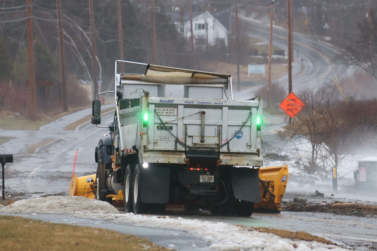
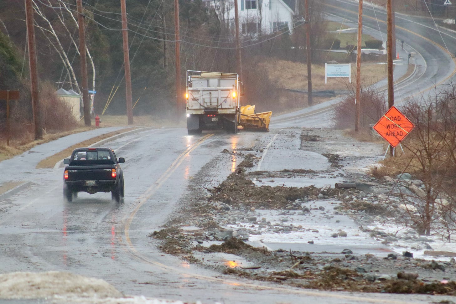
Plow trucks removed debris that washed up in Hull’s Cove, blocking the roadway, Wednesday morning.
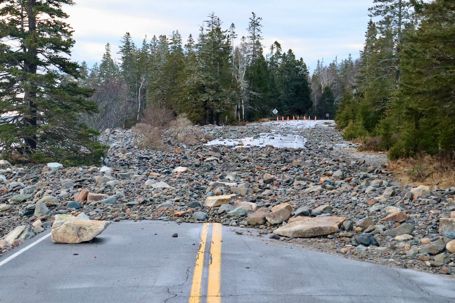
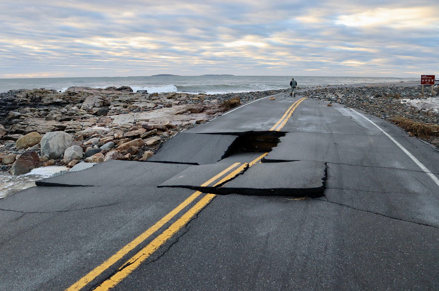
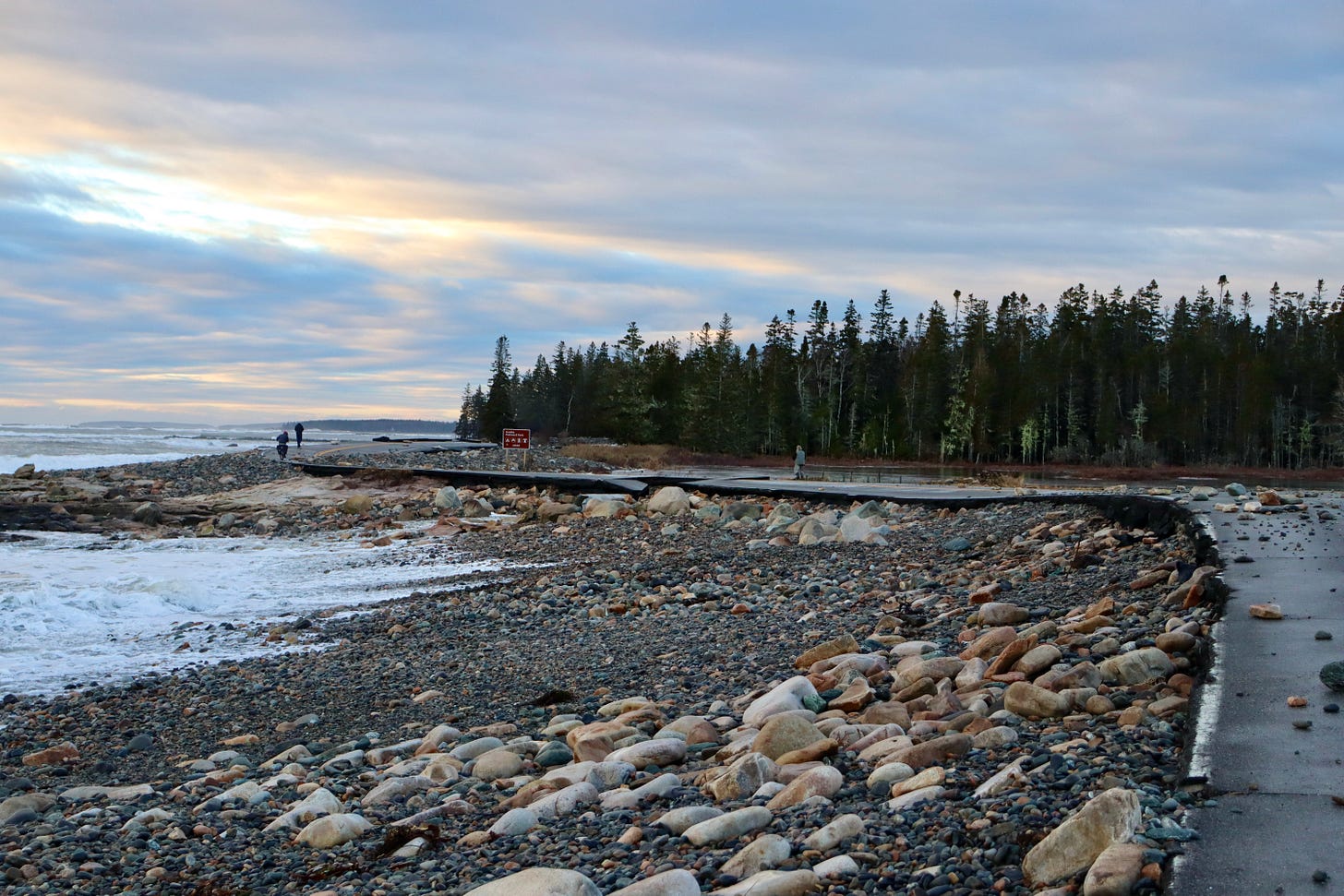
In Acadia National Park, Sand Beach was covered with water and waves crashed up the access stairs. Nearby, Thunder Hole was filled with water, large rocks were tossed onto the Park Loop Road and there was some erosion. The Schoodic portion of the park was also heavily impacted by storm surge combined with wind and tide.
Isle au Haut, part of Acadia National Park, experienced a 95-mph gust.
The Tay, a schooner that wrecked in July 1911 and had been buried under sand dunes, came into the air on Wednesday after massive amounts of sand was washed away. Crew clung to the schooner’s mast during the storm that contributed to its sinking. One by one, they swam ashore, all surviving except for the cook, J. B. Whelpley.
As Acadia National Park’s website reads,
“The Tay quickly broke to pieces. Clinging on for dear life to the broken mast, the Tay’s crew waited till the tide went out so they could scramble to the safety of the sandy beach. The crew found refuge in the Satterlee Family’s summer home. A large portion of the Tay’s cargo, close to ninety thousand feet of spruce planks, was washed ashore by the waves. The lumber was salvaged by many local islanders as well as the Satterlee family, who built a boathouse with salvaged lumber to honor the shipwreck.”
Louise Satterlee was J.P. Morgan’s daughter.
The storm that did in the Tay also wrecked a catboat, pushing it up on Rodick Island. Another accounting of the wreck specified that its cargo was spruce shingles. According to the Bar Harbor Record, it was a southwest wind that broke the ninety-four feet long schooner that had been built in 1887.
SEAL HARBOR BEACH/LITTLE LONG POND AREA/ROUTE 3 AND OTHER ROADS
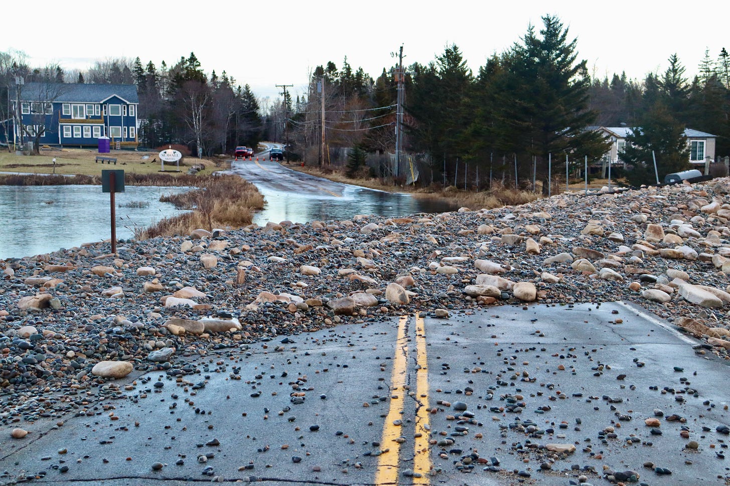
Route 3 by Little Long Pond in Mount Desert is closed. The sea wall was pounded down and swept both in and out during the storm.
Seawall in Southwest Harbor has closed. Peabody Drive in Northeast Harbor was closed. Route 3 in the Thompson Island area was down to one lane.
The Bernard wharf and dock had storm surge damage and is closed The Tremont Road in Tremont experienced serious flooding.
Seal Harbor Beach also did not fare well. The Rockefeller Boat House on Dodge Point Road had emergency response staging as a propane leak on the road necessitated attention. The road itself was shut down in sections.
According to the Schoodic Institute, “higher sea levels mean that storm waves and flooding are also higher. The worst case scenario of a storm arriving at the same time as a king tide occurred December 2022. A three-foot surge in water levels provided a glimpse of average sea level rises in the future.”
The water hit those marks on Wednesday.
SATURDAY’S STORM
Meteorologists predict another storm Saturday that also has high winds.
WHAT TO DO IF YOU HAVE DAMAGE
From the Maine Coast Fisherman’s Association:
Earlier today, we shared that individuals and businesses whose working waterfront or fishing businesses were impacted by the recent storm should share those impacts and losses with their local municipality.
The response was so overwhelming that the Maine Emergency Management Agency has stepped in to help streamline the reporting process by providing an online survey to fill out instead of calling your local town hall.
"It is imperative that individuals of private industry and privately owned commercial infrastructure who sustained property damage from the January 10th storm, including wharfs, floats, vessels, etc. document and report that damage." Commissioner Keliher (Department of Marine Resources)
HOW TO REPORT DAMAGE
The online Initial Damage Assessment Survey can be found HERE.
This is not an application for assistance nor a guarantee of financial assistance. Submission of damage information will help the State of Maine understand the extent of damage from the January 10th storm.
Individuals who sustained damages to their primary residence are encouraged to document and report that damage by filling out the Individuals & Households Initial Damage Assessment Survey (HERE).MCFA will be updating our website and Facebook with information and links.
Contact Monique Coombs if you need assistance with the survey. monique@mainecoastfishermen.org
FROM THE MAINE DEPARTMENT OF MARINE RESOURCES
Yesterday's storm has resulted in unprecedented damage to property along Maine's working waterfront.
DMR is working closely with Governor Mills and the Maine Emergency Management Agency as we assess the extent of the damage to Maine's coastline. DMR, with the support of the Maine Forest Service, will be conducting an aerial survey along the coast today, documenting the damage.
It is imperative that individuals with damaged property from yesterday's storm, including wharfs, floats, vessels, etc. document that damage, share that information with their local municipality, and ask their municipality to report documented damage to the appropriate Maine county emergency management agency.
Please share this information with anyone on Maine's working waterfront who may have experienced damage from this storm.
In the meantime, please be aware of areas along the coast, both on land and on the water, where there may be hazards as a result of yesterday's storm and proceed with caution.
Also, please note that we have a similar storm coming this weekend with an even higher tide, so it’s clear that additional preparations will be needed.
DMR will continue to evaluate this situation and will communicate updates from the Governor's office and from MEMA as efforts to recover from this storm move forward.
NEEDS YOUR HELP
If you have still images of the storm, please think of sending them to the MDI Historical Society. It needs your help.
The Society is looking for images from the storm for a project they are doing with the Schoodic Institute on sea level change.
They are particularly looking for images from today from the head of the island, Bass Harbor marsh, and Seal Cove/Pretty Marsh areas.
Please send to raney@mdihistory.org with info about when the image was taken/where the image was taken/who took the image.
LINKS FOR MORE INFORMATION
To donate to the Village Improvement Association
To donate to the Oceanarium
To donate to the MDI Historical Society
Storm Smashes Into MDI
BAR HARBOR—High winds and high tide have combined to cause damage throughout Mount Desert Island today, January 10. High tide was shortly before 9:30 a.m. The Bar Harbor Inn’s pier has taken on significant destruction and General Manager Jeremy Dougherty suggests people avoid the Shore Path from Grant Park to the town pier. The below images and video is …
Bar Harbor’s Shore Path
Goldie. Hunter. Rosie. Otis. Necromancer. Alice. Spartacus. Woof Doggy. There is a seemingly never-ending stream of canines that gallivant down Bar Harbor’s Shore Path on Frenchman’s Bay. Their leashes are long, short, red, chained, leather, canvas and sometimes non-existent as they sniff their way down the well-groomed gravel path past rocks and ocean,…
This story was updated to include a statement from the Maine Coast Fisherman’s Association. 12:30 p.m. January 11. It was updated to include a statement from the Maine Department of Marine Resources at 2: 18 p.m.










Just look at all the science for study.